A Practical Framework

Pedestrian environments expand public transportation usage(1), help regenerate and cool the natural environment, and protect the health of people of all ages and abilities.

However, pedestrian environments are often neglected to narrow grey sidewalks – the leftover of heat-trapping asphalts and impervious surfaces serving all other means of travel. When wide enough, they are nibbled on by parking lots and bike lanes, bus stops, all kinds of street furniture, light poles, and garbage bins(2). Berlin, like many cities globally, must move from corrective fixings of sidewalks towards creating climate-adaptive pedestrian environments.

UrbanCare is a 4 -step practical framework to assist city makers develop site-specific pedestrian plans and integrate convincing green technologies. 

Gap finder | Describes users’ needs and show where pedestrian environments are needed,
Diagnostics| Assesses and prioritizes environmental issues affecting health,
Planner | Aligns urban development targets with health goals with transdisciplinarity,
Designer | Accelerates decision-making through evidence and stakeholder participation.

A paradigm shift in neighborhood planning

The environmental, health, and economic outcomes of biking and walking are clear when compared to car usage. 
Less evident are the transformative benefits from planning for pedestrians, most of them unreachable for other means of travel, including biking. 

UrbanCare guides city makers along the planning process to reach transformative environmental, health, and economic benefits! 

Pedestrian planning for Urban Health!

UrbanCare helps communities, local governments, and designers create green healthy urban plans in 4 steps. 

Step 1_ UrbanCare Gap finder

The pedestrian environment is defined

First, we learn about the local population, its composition, characteristics, needs, and spatial requirements. Then, priority destinations are mapped such as, medical offices, schools, and parks which are located at a walking distance from public transportation stops (max 1 km).
In winding up, the priority destinations are connected
 to form ‘pedestrian loops’; as seen in upper slides. These are pedestrian priority routes which can be retrofitted to be car-free and highly integrated to nature.

Step 2_ UrbanCare Diagnostics

Pedestrian loops are evaluated

Observations and surveys are done along the pedestrian loops to gather information and data on environmental health risks and outdoor threats to people.
The evaluation targets the needs and requirements of vulnerable groups such as children, the elderly, and people with disabilities. Reviews, specialists interviews, and field studies are realized and reported through user-friendly infographics.

Step 3_ UrbanCare Planner

Different sets of knowledge and green technologies are integrated

Tools for transdisciplinarity are offered to help a mix of experts understand the local urban health and planning challenges, identify key stakeholders, and align goals.

‘The planner’ is a web-based management service that helps to think visually and discuss the implementation of policy and integration of green technologies into the project. Stakeholders from different sectors can smoothly monitor resource allocation, deadlines, workflow progress, and targets achieved.

Step 4_ UrbanCare Designer

Play Video

Green healthy pedestrian environments are designed

The project’s data is embedded into a 360° virtual pedestrian journey offering designers key environmental information within spatial context. 

UrbanCare Designer is a data model with immersive visualizations to enhance stakeholder participation and engagement. Through vivid pedestrian journeys, users understand the complexities of the project and gain  confidence to discuss and tackle issues. The informed opinion of all stakeholders accelerates the decision-making process.

We teach UrbanCare’s steps & tools,

Directly assist local teams apply them, 

Help manage a project from concept to creation.

UrbanCare cases under development across Europe

A healthy neighborhood in Berlin, Germany

A climate-friendly medical campus in Florence, Italy

A medical neighborhood in Nicosia, Cyprus

A health-promoting hospital in Gothenburg, Sweden

Collaborating partners

UrbanCare,
a practical framework to develop regenerative landscapes
for public health and energy management

Alvaro Valera Sosa (2021)

Project development

BHL Building Health Lab
Alvaro Valera Sosa: Conceptualization, Methodology, Investigation, Analyses
[email protected]

Webpage Credits

BHL Building Health Lab
Alvaro Valera Sosa: Original draft, Writing-reviewing, Editing, Design, Administration.
Netra Naik: Original draft contribution; Software, Data curation.
Julia Reißinger: Software, Data curation.

Links and sources of interest

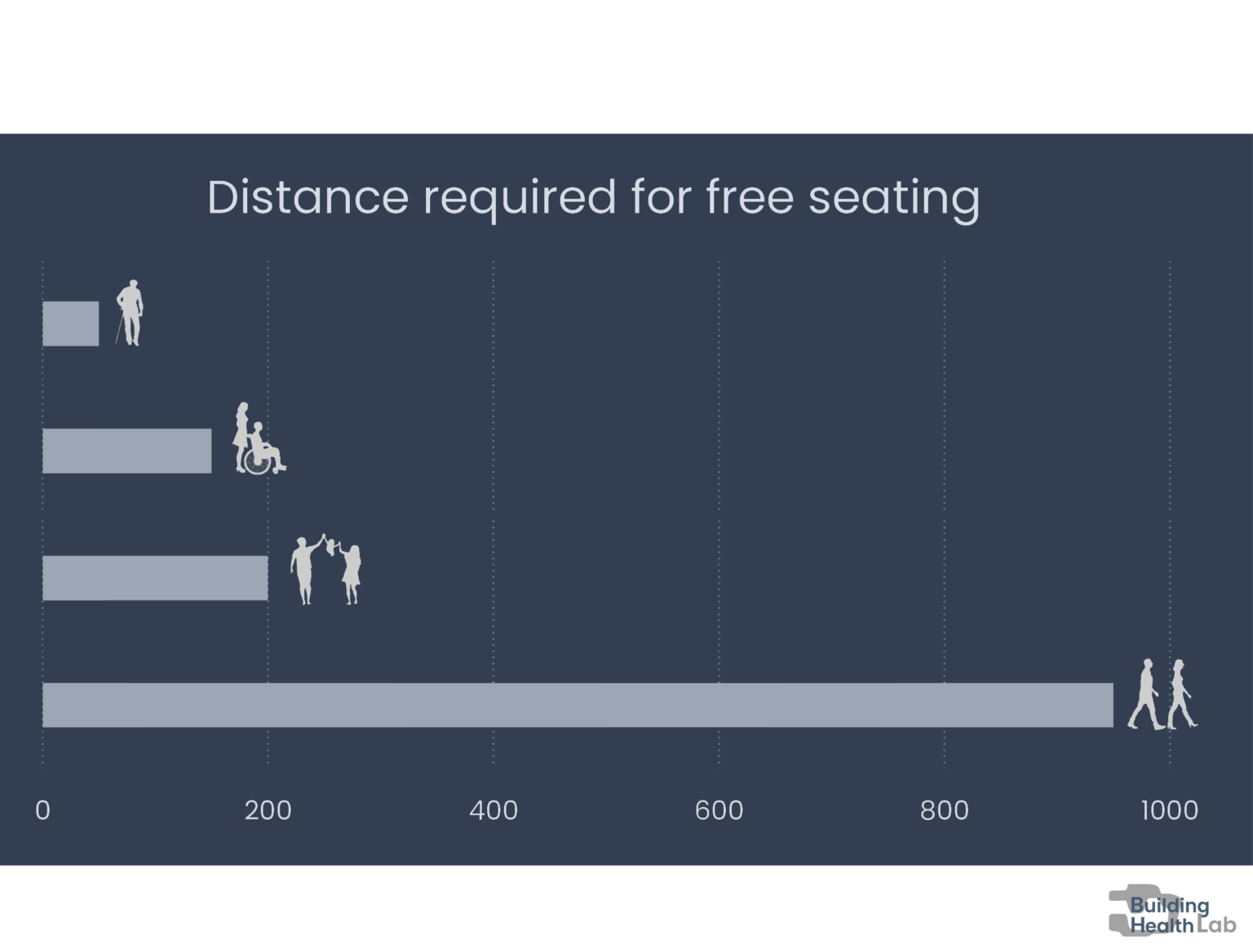
1. https://www.completecommunitiesde.org/planning/complete-streets/walkable-communities

2. https://www.fuss-ev.de/planung-regeln-sicherheit

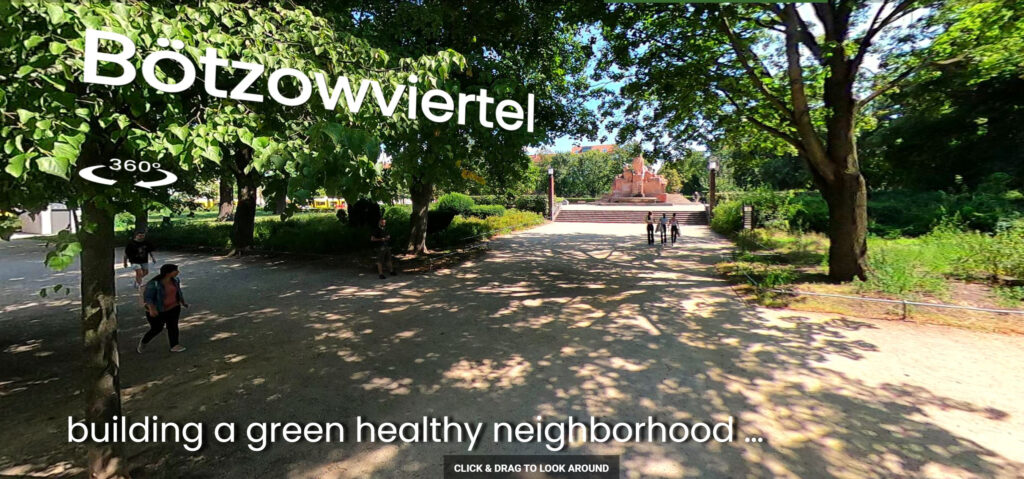
3. https://www.tagesspiegel.de/berlin/kiezbummel-in-berlin-prenzlauer-berg-das-boetzowviertel-hat-grund-zum-feiern/8700982.html

4. https://www.stadtentwicklung.berlin.de/nachhaltige-erneuerung/aktuelles/prenzlauer-berg/artikel/ausstellung-sanierungsgebiet-boetzowviertel-eroeffnet

5.https://fbinter.stadtberlin.de/fb/index.jsp?loginkey=zoomStart&mapId=k_vms_tempolimits_spatial@senstadt&bbox=385546,5818090,396644,5824313

6. https://www.morgenpost.de/bezirke/pankow/article232525871/Prenzlauer-Berg-Hufelandstrasse-wird-zur-Fahrradstrasse-Hufelandstrasse-wird-Fahrradstrasse.html

7. https://www.prokiez.de/

8. https://www.berlin.de/sen/uvk/en/traffic/transport-policy/berlin-mobility-act/

9. https://www.prokiez.de/mitmachen/

10. https://www.fuss-ev.de/

11. https://www.hrw.org/news/2021/07/01/germany-inaction-heat-plans-threatens-health

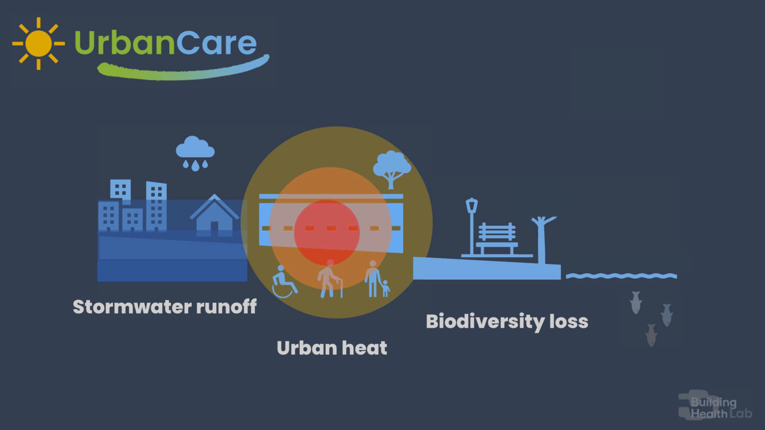
12. Li, X. L. (2019). Urban heat island impacts on building energy consumption: a review of approaches and findings. Elsevier, 1–43. https://www.sciencedirect.com/science/article/pii/S0360544219303895

13. https://www.bmu.de/en/topics/water-resources-waste/water-management/policy-goals-and-instruments/water-protection-policy-in-germany

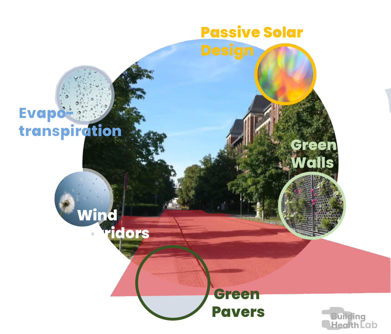
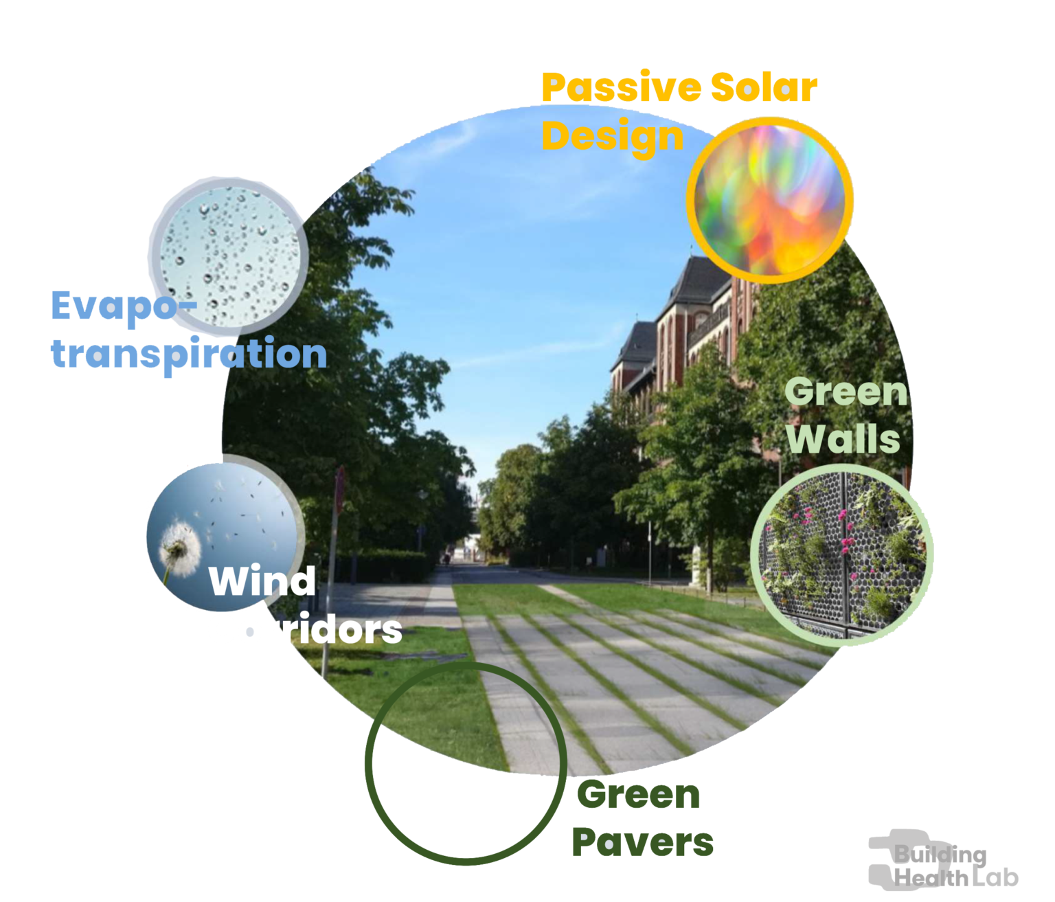
14. https://www.hcu-hamburg.de/research/forschungsgruppen/reap/reap-projekte/bluegreenstreets/

15. Jekel and Sieker. (2010). Technical University of Berlin Dept. of Water Quality Control, Rainwater management for urban drainage, groundwater recharge and storage. https://www.hmw.tu-berlin.de/fileadmin/i41_hmw/12_DAAD_Rainwater-Jekel-Chile2010.pdf

16. Senate Department for Urban Development and the Environment and Chamber of Commerce and Industry of Berlin. (2014). Business in Berlin Supports Biodiversity Recommendations for Action – A Guide. https://www.berlin.de/sen/uvk/_assets/natur-gruen/biologische-vielfalt/publikationen/leitfaden_biologischevielfalt_englisch.pdf

17. https://www.museumfuernaturkunde.berlin/en/science/research/society-and-nature/biodiversity-policy-lab

18. Parris. (2018). The seven lamps of planning for biodiversity in the city. Cities. Published. https://doi.org/10.1016/j.cities.2018.06.007

○ Climate friendly & biodiverse landscapes help cure chronic diseases

○ Community care closer to people improve patient outcomes