UrbanCare, a three-phase methodology for city makers to build efficient spaces for urban health.
UrbanCare is a three-step methodology that helps neighborhood communities, planners, designers, and developers create outdoor spaces that improve population health and energy efficiency levels of buildings.
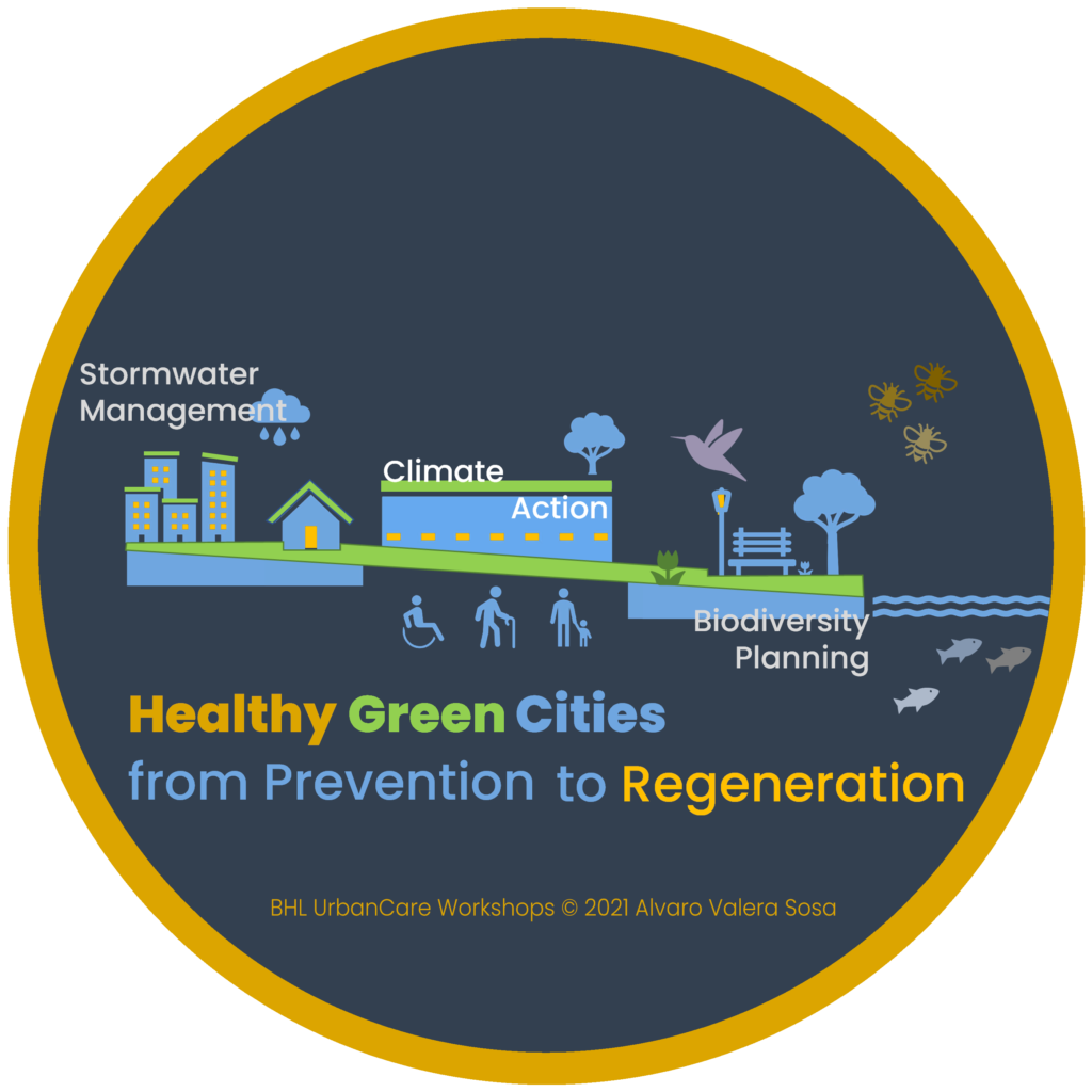
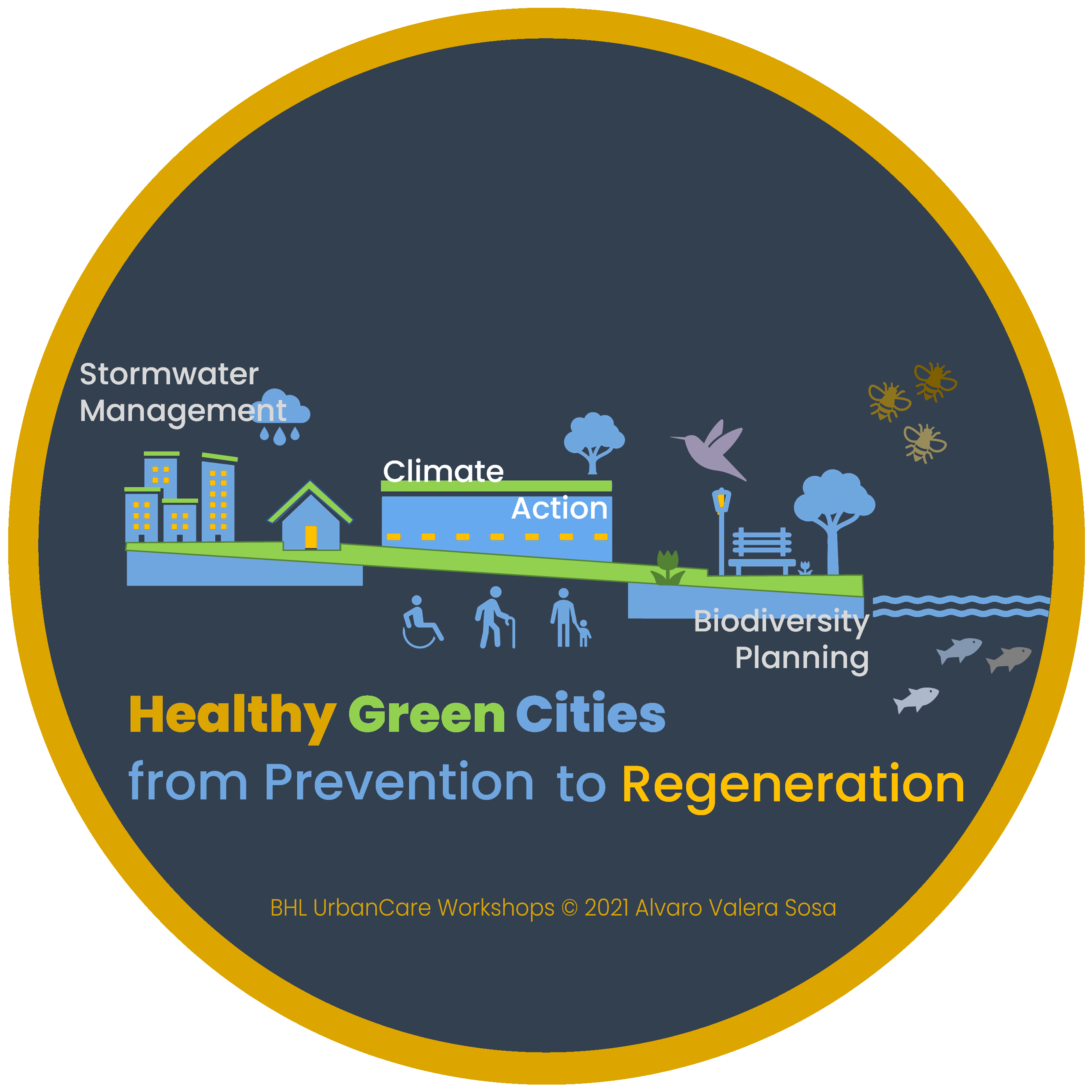
Our BHL team and UrbanCare specialists help planning teams and stakeholders apply the UrbanCare methodology to develop projects with Healthy Green Cities principles:
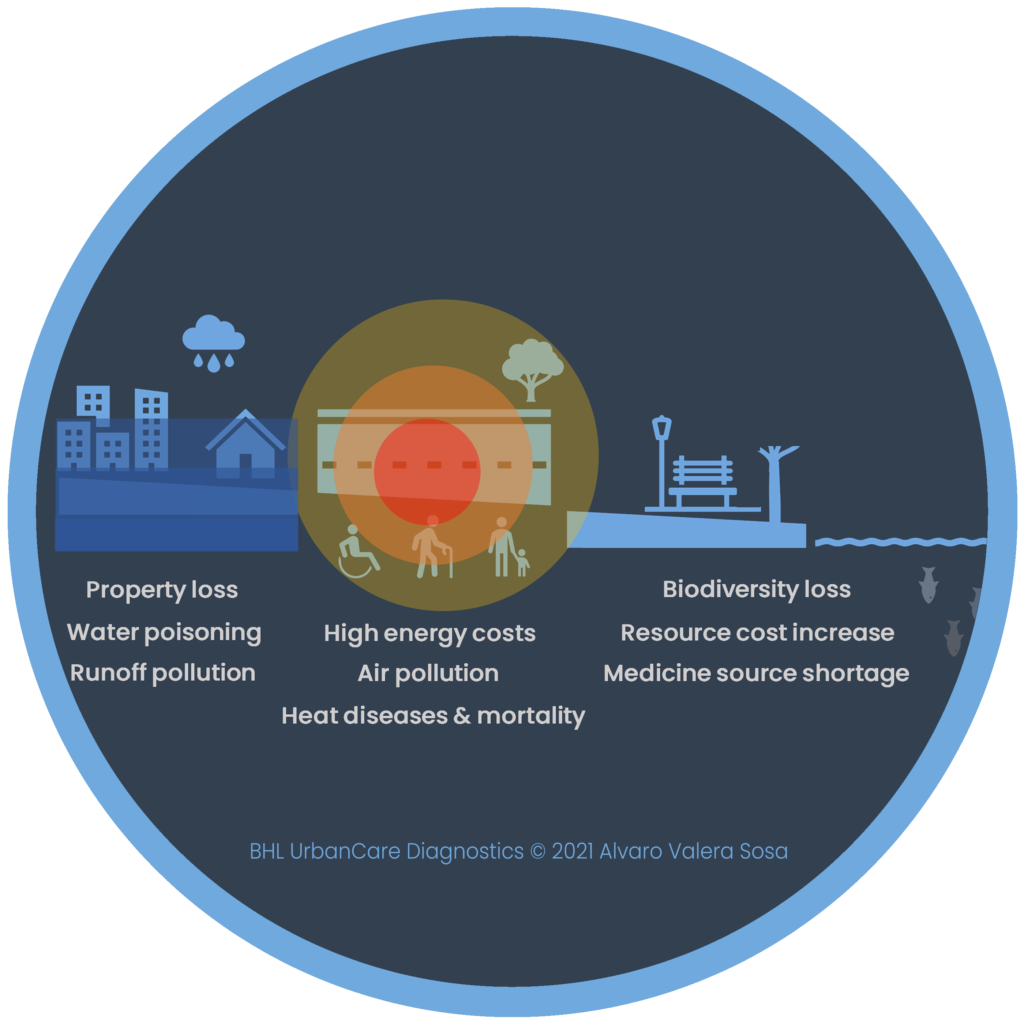
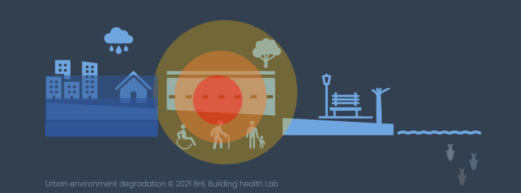
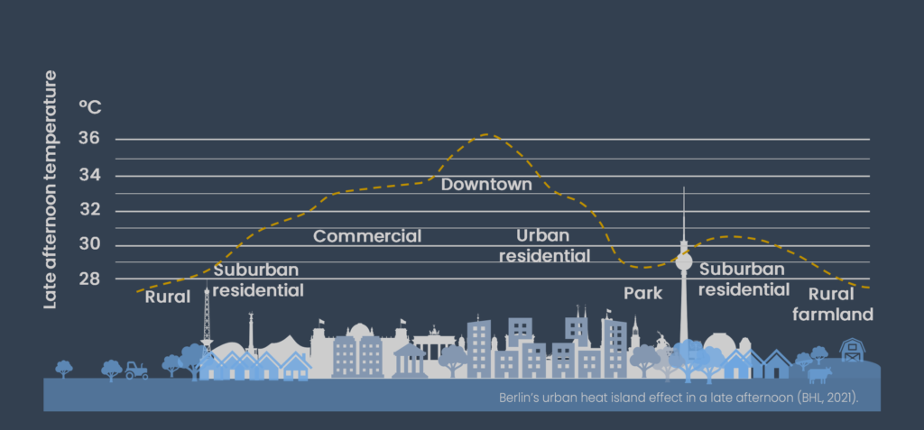
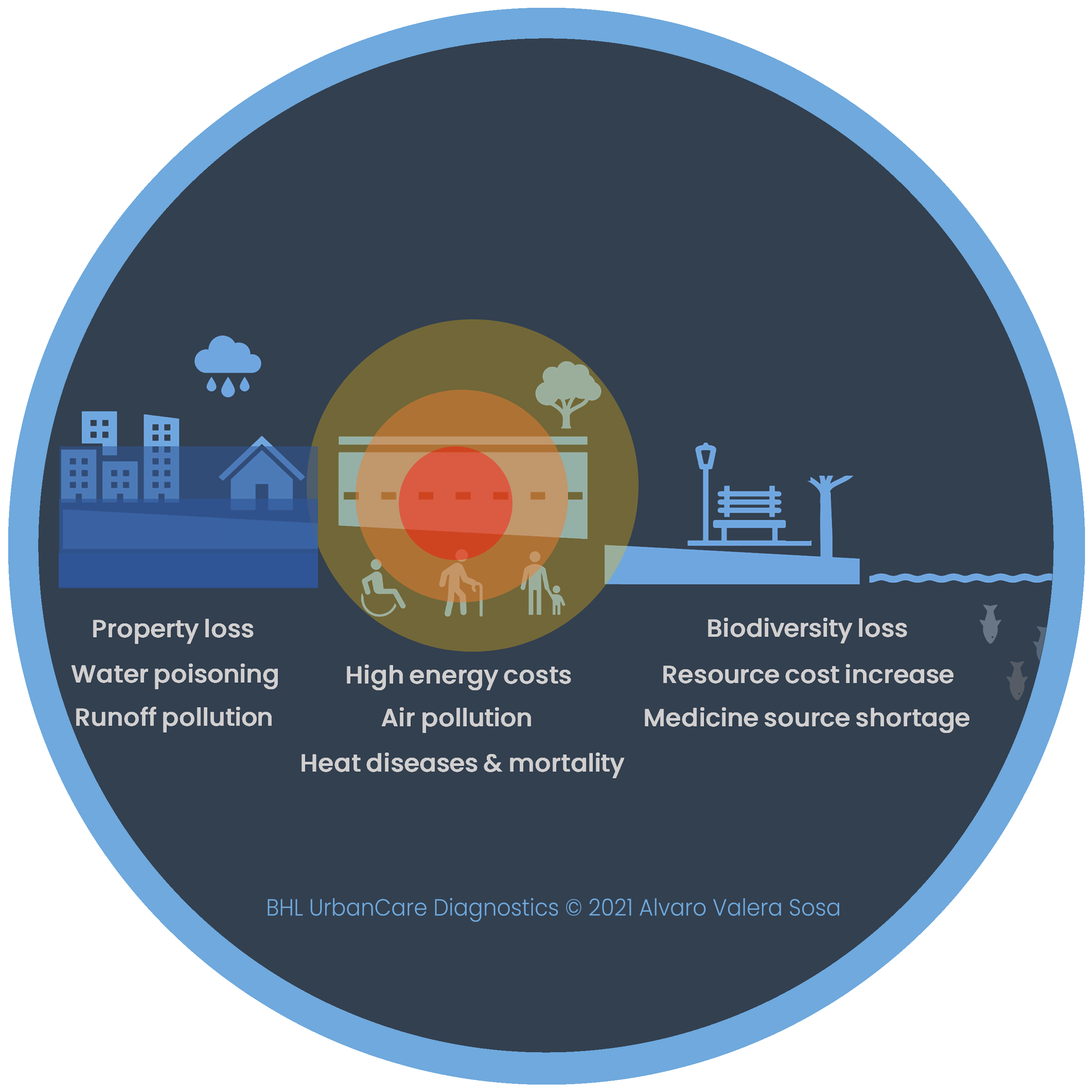
Eliminate hazardous urban heat spots through climate designs
Stop rainwater runoff and water pollution levels with water-sensitive planning.
Reduce hard sealed surfaces with a diverse and practical green
Transform sidewalks into pedestrian environments and public spaces designed for everyone, especially children, the elderly, and people with different types of disabilities.
Network priority locations for healthcare, physical activity, healthy diets, and positive social interactions.
Urban Health research use indicators to gather valuable data on health disparities and physical environmental factors that affect health. They produce evidence for decision-makers to confidently accelerate spatial planning and design projects, and inform policies aiming to improve urban climate and health outcomes.
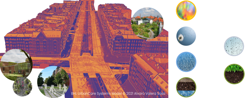
S1_ Urban Health Indicators
UrbanCare’s research phase invests heavily in producing high-quality indicator tools to collect physical environmental and population data that describe the urban climate and health situation of a site. These composite indicators are practical to survey an urban site or evaluate spatial proposals at multiple scales and dimensions.
The quantitative research activities systematically observe and study urban ecosystems (structures and dynamics) with surveys and checklists created with the indicators (S1). Desk research gathers information to develop user personas of context-specific vulnerable populations (such as children, the elderly, people with disabilities, patients, and the socially disadvantaged) and slow groups (such as tourists, street workers, or merchants). The field observations at the street level assess the many physical environmental issues that affect pedestrian health and building energy efficiencies, such as heat spots, surface runoff, and biotope loss along sidewalks.
S3_ Qualitative Research
The qualitative research activities include community participation to describe and evaluate pedestrian walkways (loops) in an urban area between priority destinations such as healthcare, educational, recreational, nutritional, and cultural services. Focus group interviews with vulnerable and slow groups give first-hand insight into active mobility requirements and uncover issues initially not considered. Semi-structured interviews and multidisciplinary dialogues with health and environment specialists illustrate technical challenges to traffic risks, heat exhaustion, air pollution, and various other environmental threats to urban ecosystems.
The high-speed pace of digital transformation allows not only to analyze data but to act on it. The right visualization of data highlights the most important aspects of a project, bringing new insights and communicating them more persuasively. As a result smarter actions and more accurate outcomes are possible to attain.
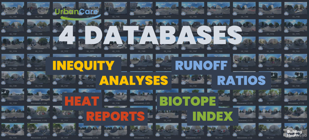
S4_ Databases
Consolidating local environmental and user persona data into local databases optimizes search times exponentially with focused and accurate results. The data and databases produced can be considered an essential resource for municipal, regional, or even national projects aiming at economic growth, job creation, and societal progress in general. They will be open data sources for each site that can bring invaluable insight into various sub-fields of climate and health, such as food security, education, intelligent transport systems, and smart cities.
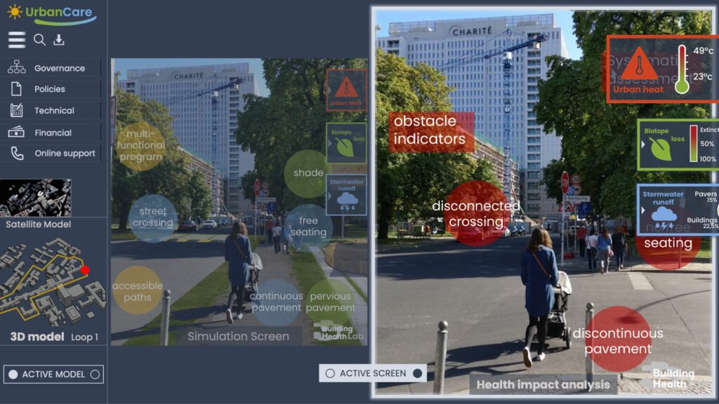
S5_ Data Viewer
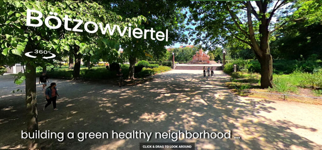
The UrbanCare Data Vieweris a web-based tool for citizens and other stakeholders to easily visualize and interpret data from all five databases (S4). Research results are fed into databases and made visible through a 360° journey software that allows users to navigate the site and click to access data at different urban scenes. The viewer permits users to easily navigate and zoom into multiple urban scenes. It allows users to comment on the urban scenes opening the opportunity to input ideas and introduce citizen-led innovations.
S6_ Web Platform
The Web Platform is a spatial planning environment that (i) allows and assembles information input from various sources, (ii) facilitates user interaction, and (iii) supports management, planning, and design decision-making. The Platform comprehends urban 3D data such as topography, building volumes, street networks, and green/blue infrastructure. It builds on the Crowd Movement model developed within the Chalmers DTCC’s framework allowing pedestrian and outdoor user movement simulations. The platform supports data and assessments from the UrbanCare Data Viewer (S5) and other sources using Urban Health Indicators (S1). The whole range of inputs, allows an iterative process for researchers and designers to continuously adjust their spatial concepts to the context’s environment and feedback from residents and users.
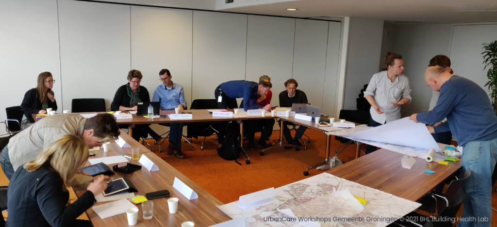
III. Decision-making Workshops
Main outputs:
Urban Health spatial proposals
Case study for local authorities to pilot a real-world project
The Decision-making Workshops are central to accomplishing a knowledge transfer. In four sessions, 8 to 12 participants rehearse the techniques to gather the evidence and review the evidence quality on ecosystem degradation, user needs, and urban health spatial requirements.
S7_ Gap Finder
The first session uses the Data Viewer (S5) to start discussions on the case study within a diverse team of participants. The main objectives are to communicate the UrbanCare framework know-how and make available all the data managed on the case.
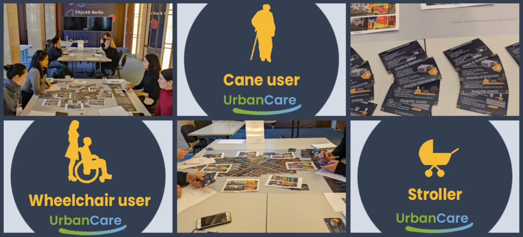
Through user personas, workshop participants take note of their pedestrian experience following pedestrian loops. These are the possible walkways for pedestrians to travel between priority destinations in the urban area, such as healthcare, educational, recreational, nutritional, and cultural services.
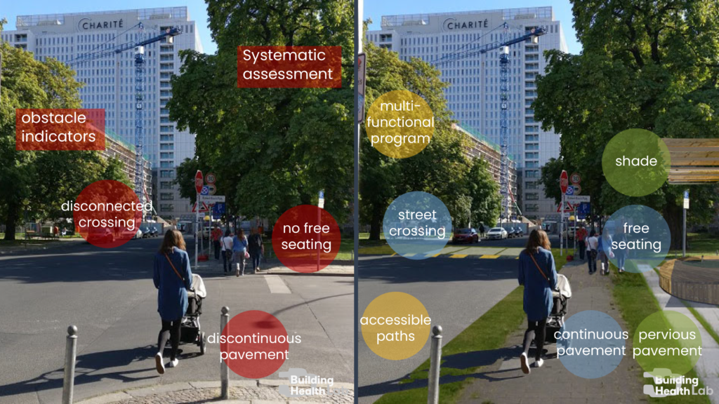
S8_ Urban Diagnostics
Diagnostics, engages participants in looking deeper into the environmental conditions of the pedestrian loops and the needs of outdoor users by visually navigating the five databases (S4). Through the Data Viewer or with the UrbanCare game board and cards, participants pin and describe environmental threats and obstacles at street connectors such as crossings, stops and stations, respite areas, and entrances to priority destinations (S7) from a User Persona perspective.
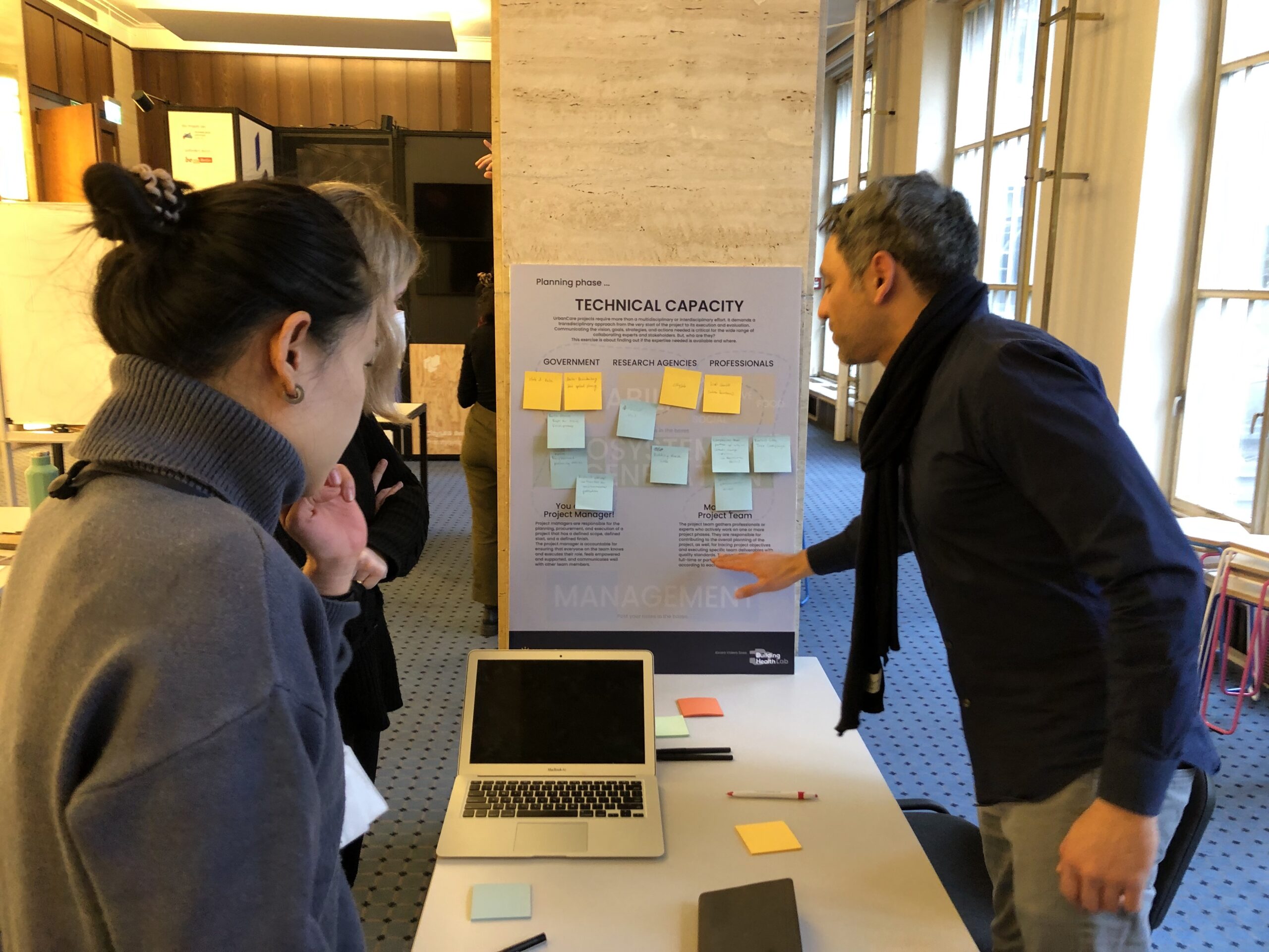
S9_ Planning
Planning is about understanding the decision-making processes in developing urban projects and using evidence to inform them. Participants use pin-up boards to recreate the planning process of the case’s spatial solution from initiation to end, focusing on policy, technical capacity, and finances. During the session, the group defines the main actors and stakeholders of the project and appoints a project manager that recreates the transdisciplinary workflow.
S10_ Design
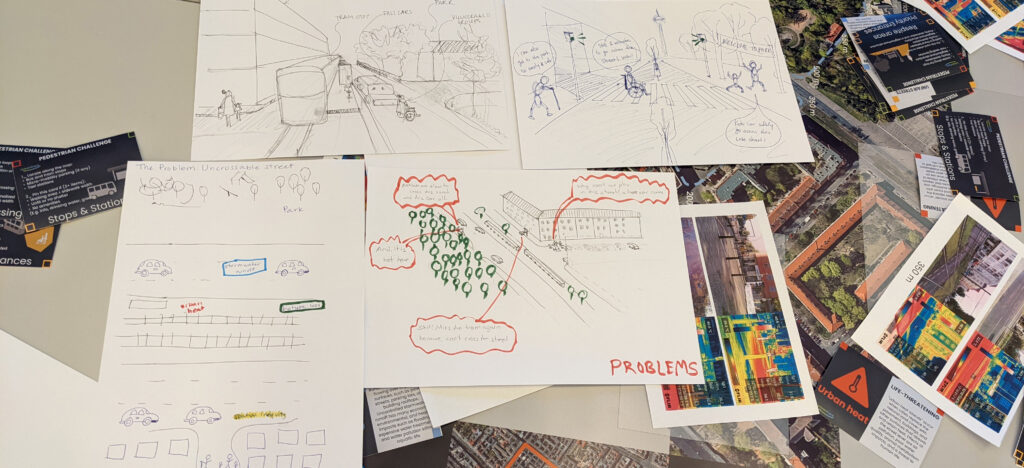
Design is the last session where participants create urban scene visuals for each loop that communicate the needs, problems, and spatial solutions that build pedestrian health and enhance the quality experience of vulnerable groups. The goal is to generate well-informed sketches that can convince decision-makers to act confident and fast.
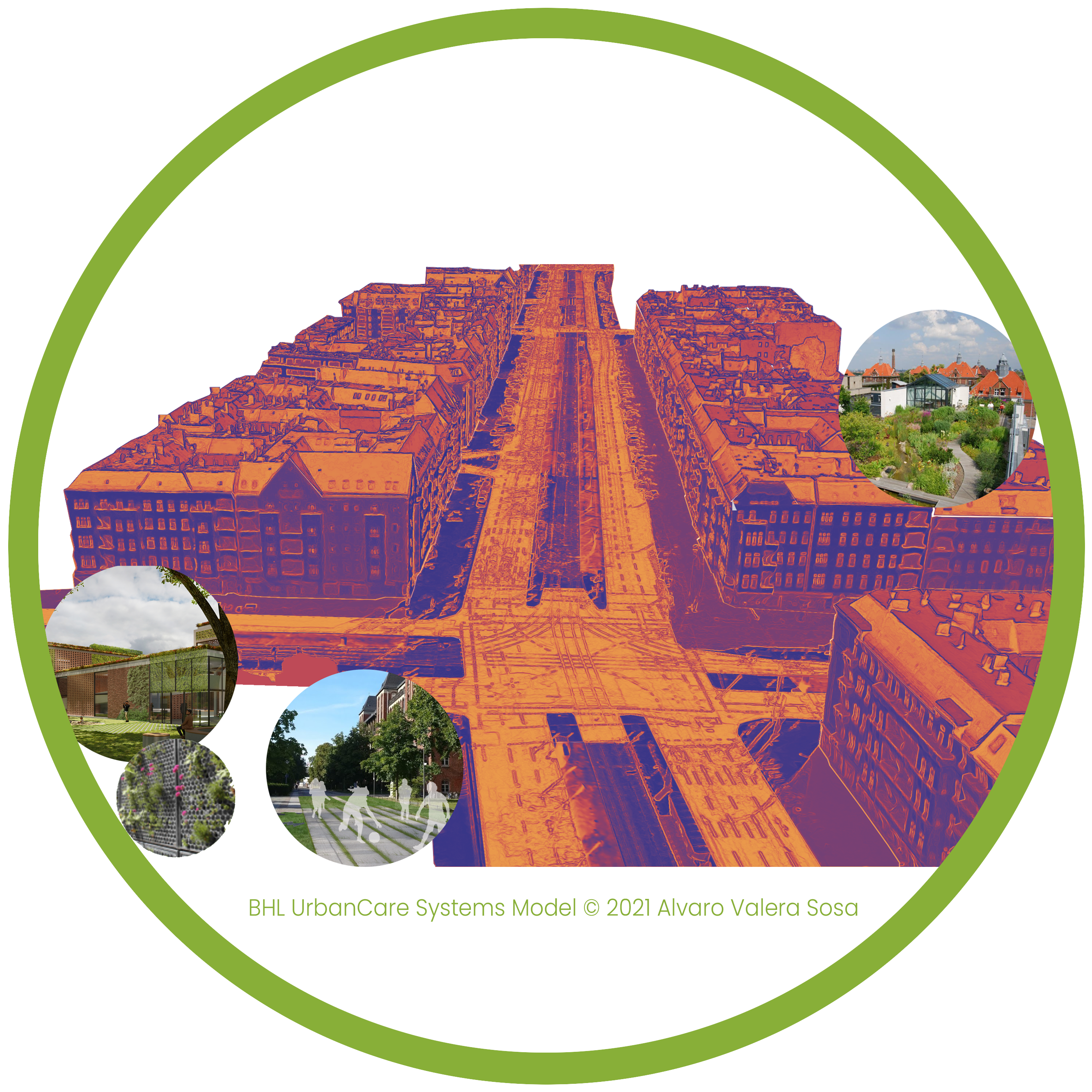
UrbanCare Cases
Four cases are being structured at various neighborhood-scale locations in Europe:
A healthy neighborhood in Berlin, Germany
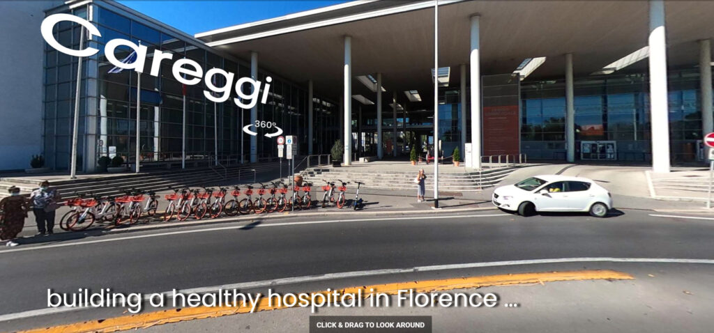
A climate-friendly medical campus in Florence, Italy
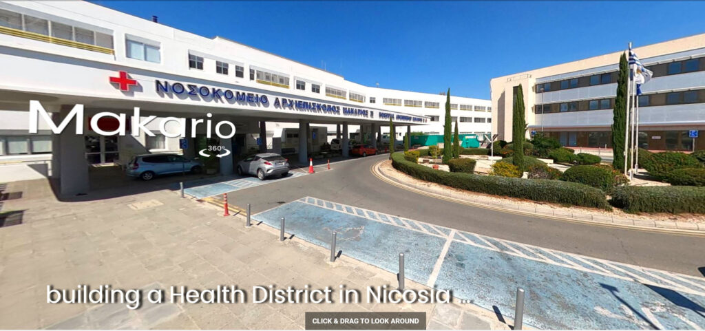
A medical neighborhood in Nicosia, Cyprus
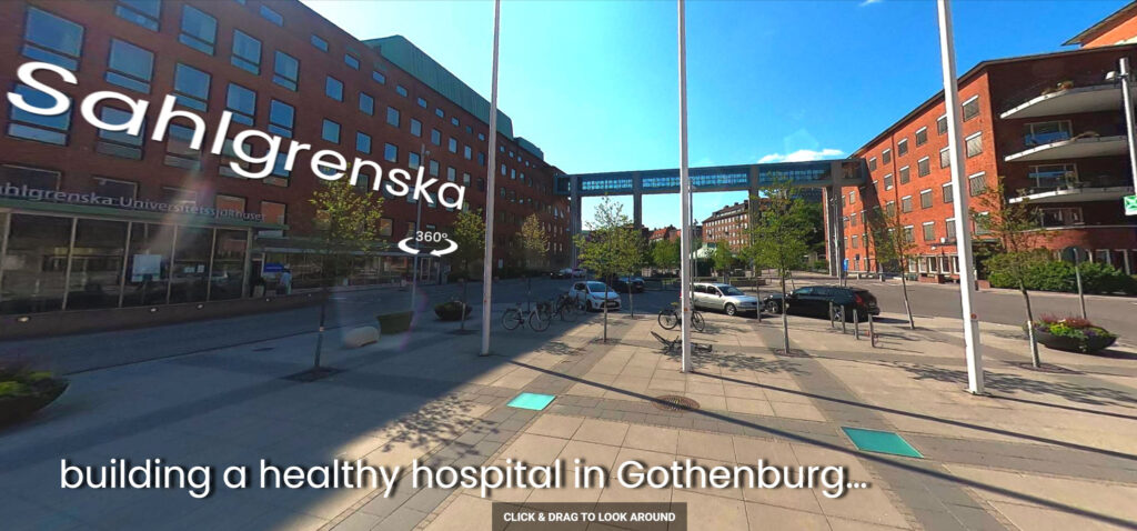
A health-promoting hospital in Gothenburg, Sweden
Information and data on these cases are updated frequently …
UrbanCare, a practical framework to regenerate urban ecosystems with evidence.
Alvaro Valera Sosa (2021), Update 03.04.2022
Project development
BHL Building Health Lab Alvaro Valera Sosa: Conceptualization, Methodology, Investigation, Analyses [email protected]
Webpage Credits
BHL Building Health Lab Alvaro Valera Sosa: Original draft, Writing-reviewing, Editing, Design, Administration. Netra Naik: Assistance, Software, Data curation. Gregorio Pezzoli: Software, Data curation.